- Clissold Park
- City Road Basin
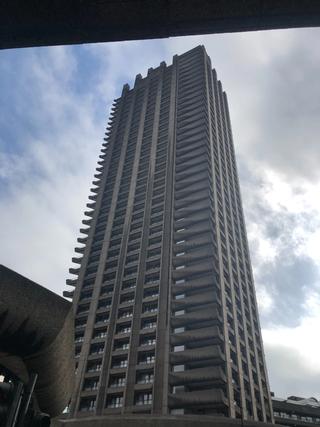
- The Barbican
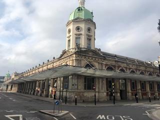
- Smithfield Market
- Mount Pleasant Sorting Office
- King’s Cross Station
- St. Joseph’s Church, Highgate
- Dartmouth Park Hill
- Parkland Walk
I rode this route without knowing it would become the starting point for this project – I just had some spare time one February day in lockdown, and it seemed like a fun thing to do. As I've lived in Islington for most of the time I've been in London, it shouldn't have been too surprising that an exploration of its borders turned into something of a sentimental tour of the last ten years of my life. I suspect the experience won't be quite the same for you, but nonetheless this route offers plenty to look at along the way, fairly ideal road conditions, and a little climbing – but not, in my opinion, too much.
As this was my first borough route, I spent an undue amount of time agonising over which direction to start off in, but ultimately settled on a clockwise loop for mostly instinctual reasons, probably because it lines up better with the direction my day-to-day riding usually takes me, and because it takes in some familiar climbs on the back half – York Way and Dartmouth Park Hill – and leaves us free to pick our way through the small streets around Crouch Hill while descending, rather than climbing.
As we'll find with later routes, following borough borders to an exact degree is sometimes impossible, and inevitably either direction of the circle includes elements of compromise. Islington is no exception and in fact probably has a higher than typical amount of one-way interference. Borough boundaries are strange and ancient things, and one-way systems aside, there are plenty of extra turns and otherwise pointless deviations along these routes to follow the borders more faithfully. Fortunately almost all of Islington’s boundary follows the roads – not something universal to all boroughs – so there are only a couple of places where we have to stray from the path for the sake of practicality. Either direction should be enjoyable – if in doubt, try both, and report back!
The closest point on the boundary to where I live is the junction of Blackstock Road and Mountgrove Road, so that’s where we’ll start. We head off up Mountgrove Road, immediately treated to the striking tile signage of the former builder's merchants on the corner of King's Crescent. We reach Green Lanes, turning right to follow the edge of Clissold Park, before taking a quick dog-leg on to Petherton Road (past Primeur, a great restaurant in an old garage) and Leconfield Road, emerging by The Leconfield pub. Skipping over the top of Newington Green we join Matthias Road, taking in the juxtaposition of the spotless new housing development on the left before the somewhat more ancient Anvil House (1864) a little further on, and the stalwart Army and Navy pub on the right. We’re skirting the curiously named neighbourhood of Ball’s Pond (if there is still a pond, I have not yet discovered it) as we follow Boleyn Road, passing the Old Cholmeley Boys' Club (1898) on to Kingsland Green, and then cutting through a short section of pavement at the end to drop on to Ball’s Pond Road – easier when the lights at the nearby junction are red.
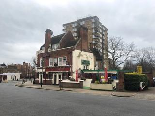
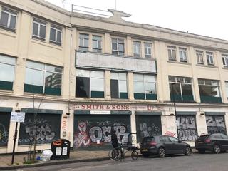
We turn left off Ball’s Pond Road on to Southgate Road – spotting The Hunter S pub at the top. This is well worth a visit in the dark of night (or, at a pinch, late afternoon), and has a surreal interior its namesake would probably have enjoyed. We continue on Southgate Road, eventually passing the De Beauvoir Deli (where an excellent snack can be had) all the way down to the Regent's Canal, which we’ll meet a couple of times today. This is a good place to start looking for the different boroughs’ street signage – here it’s Islington to the right, and Hackney to the left. Reaching New North Road, the boundary follows the canal and you can take the towpath if you wish, but I prefer to avoid it so the route follows Arlington Avenue instead, and at the end a few yards on the pavement will take you to a little walkway (not the bridge – beside it) that joins Baldwin Terrace. Wharf Road takes you down to the City Road Basin and into the forest of shiny luxury residential towers that line it. These have all sprung up in the last few years, and offer some pretty impressive views from the street.
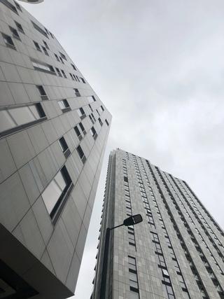
On City Road, rolling past The Shepherdess and behind it The Eagle of Pop Goes the Weasel fame, Eagle House (an Art Deco-inspired residential building with eagle statue atop it), Moorfields Eye Hospital (with slightly unsettling giant eye on the facade) we reach Old Street roundabout (no longer a roundabout) and keep left onto the cycle track outside the (current) Shoreditch Fire Station. Don’t miss the street art on the walls of Vince House just after. We’re heading to the right at the fork of the cycle track to Great Eastern Street, to then immediately swing off onto the crossing over to Paul Street by the Great Eastern Street fountain dating back to 1881, and the Old Shoreditch Fire Station (1896–1964) on the corner, now a Wahaca and shared office space. At the top of Great Eastern Street from where we just crossed over, an extensive building site covers where The Foundry once stood, a pub and art venue beloved of Banksy, Pete Doherty, and London's community of bike messengers. This was closed in 2010 but it would be almost a decade before construction of its replacement (a hotel) would begin in earnest.
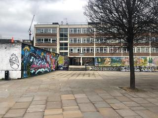
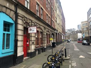
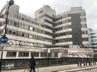
The Islington boundary follows Tabernacle Street and there’s initially a bike lane allowing you to proceed against one-way traffic, but you’ll soon meet a no-entry sign at Leonard Street so you might want to instead follow Paul Street from the top to avoid this – or just proceed with caution as I did on a quiet Saturday. Either way you’ll end up on Paul Street – some interesting derelict warehouses at Clere Place en route, and the optimistically named Development House which is now mostly a canvas for graffiti artists, their work contrasting with the original sculpture you can see on the south-east elevation if you look back over your shoulder. This building is slated for demolition and redevelopment any day now, though the planning consent requires reinstatement of the sculpture – but better see it while you can, just in case. Jane Sketching has written extensively on Paul Street and this (re)development, and what may come next.
Crossing Worship Street on to Wilson street there are some good views over to the left contrasting buildings old and new. This is another good place to spot borough street signs to the left and right, including some references to the historic Borough of Finsbury (now a district of Islington). At the crossroads by the Flying Horse pub, you now stand at the corner of three boroughs – Islington to the west, the City to the southeast and Hackney to the northeast.
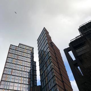
Reaching South Place, we’re now at the south-east corner of the borough. Crossing Moorgate onto Ropemaker Street, check out the impressive entrance to Citypoint on the left. We’ll wiggle between the office buildings to reach Chiswell Street for a sudden view of the Brutalist might of the towers of The Barbican (Cromwell Tower closest) before we head into the Beech Street tunnel. Halfway along the tunnel we’ll take a right through the bollards on to Golden Lane. At number 88, on the corner with Roscoe Street, you can see the very tall, very narrow building that houses Blair Associates Architecture. The borough boundary passes through the estate to the left here, but following Baltic Street East (becoming Baltic Street West) to Goswell Road is close enough. We’ll head back down to the crossroads by Barbican station and another tower (Lauderdale Tower this time) and turn right on to Long Lane, as we can’t follow the actual boundary at Charterhouse Street in this direction. If you did want to pause to explore the Barbican Estate, this is a good point from which to do so. I've cycled past it a thousand times, but only recently stopped to look around the interior – it really is spectacular.
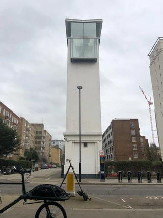
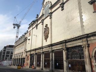
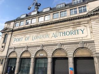
We approach Smithfield Market, a venerable and striking market complex – but don’t miss the spiral (helical, technically) entrance to Smithfield Car Park on the left which featured briefly as a location in Skyfall. Much could be written about Smithfield Market alone but for now let’s cut through to Charterhouse Street and note the impressive shield of the old Central Cold Storage warehouse as we emerge from beneath the market canopy, and the amazing frontage of the Port of London Authority building beside it. The western part of the market complex is undergoing a confusing redevelopment but (for now) there are vestigial hoardings for businesses long closed along this northwestern edge. The market itself is still in enthusiastic use, but most of its activity takes place long before most people are awake of a morning.
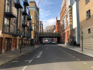
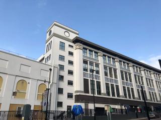
From here it’s on to Farringdon Street – a right turn from Charterhouse Street not strictly permitted so you might want to take it in two stages. Passing along Farringdon Street, you can see the Zeppelin Building on the left after a few hundred yards, so named because its predecessor on the site was destroyed in a zeppelin raid during WWI. From there it’s left at the crossroads on to Clerkenwell Road and then quickly right on to Herbal Hill, dropping down to Warner Street and passing beneath the pretty bridge that carries Rosebery Avenue. Some hidden-gem pubs along here before we reach the corner of Mount Pleasant Sorting Office with the names of various cities detailed on its huge exterior. We move along Phoenix Place and pass the Mail Rail visitor centre on the right and The Postal Museum on the left. These are both well worth a visit, the Mail Rail (a narrow-gauge underground freight railway formerly connecting several London sorting offices) being of particular note.
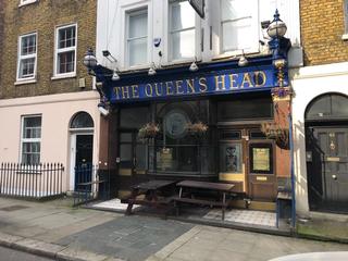
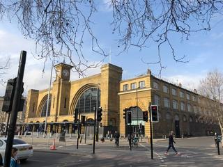
We turn right towards King’s Cross Road before heading left on to Acton Street and passing The Queen’s Head, held by some to be the best pub in London. From there it’s on to Gray’s Inn Road where you can move over to the far left and eventually, when the station is in view, take the bike path before the traffic lights in order to then take the crossing onto York Way outside the impressive shape of King’s Cross station. Alternatively you can stick on the right and mix it up with the traffic, which is fine on quiet days. Once on York Way we pass alongside the platforms and sheds of the station, but the high wall sadly prevents much being seen. King’s Place (home of the Guardian and Observer) comes up on the right as we cross the canal again and start the ascent of York Way – if refreshment is needed at this point you can turn left at King’s Place and head to Granary Square, which has many decent eateries and a few coffee shops.
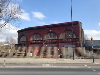
Carrying on up York Way, don’t miss the remains of York Road underground station on the right, with the distinctive burgundy frontage of architect Leslie Green. We follow the road downhill past the apartment blocks on the north side of the Granary Square and King’s Cross redevelopment site, pass under the hefty deck of the rail bridge and then climb our way up this steep section towards the Market Estate. The borough line follows York Way but the one-way system requires us to follow round to the left on Camden Park Road, crossing Camden Road on to Torriano Avenue.
Summer 2022 update: The section of Dartmouth Park above Magdala Avenue is currently southbound-only for about 50m due to construction work. You may need to take to the pavement or walk, FYI. It's a temporary setup but may be in place for a while judging by the scale of works being undertaken.
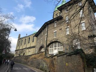
A short climb up to Brecknock Road, and we turn towards Tufnell Park station, crossing the junction on to Dartmouth Park Hill, the main climbing challenge of the route. This initial section is followed by a plateau then a slight descent, before the road ramps up steeply again, taking us up to Highgate. This is one of my favourite cycling climbs in the area, sweeping as it does past the high walls and green copper dome of St. Joseph’s Church, Highgate. This second section is of a slightly unkind gradient, and though it can be done on a single-speed bike, it’s a bit of an effort. Once at the top, we cross on to Hornsey Lane – catch a glance at the view to your right as you cross the junction. The road shortly crosses the iconic Hornsey Lane Bridge over Archway Road, and there are further great views to either side (but especially the right, looking south) on a clear day. A good chance for recovery here as we freewheel the considerable length of the lane all the way to the junction with Crouch End Hill.
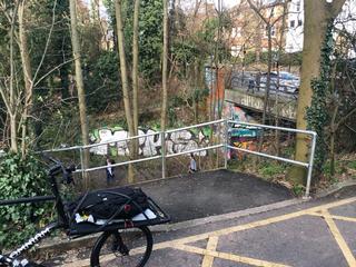
It’s almost all downhill from here. A quick right-then-left into Hornsey Rise Gardens, then look out for a small alley between nos. 41 and 43. Scoot up here (probably best to walk the first bit) keeping straight on to find yourself in the hideaway of Crouch Hill Park – follow the paved road with the large rubber speed bumps and you’ll come to a short ramp with a barrier that leads on to Crouch Hill. Just before that, you get a view down onto the Parkland Walk, the disused railway path that connects Finsbury Park to Muswell Hill.
We join Crouch Hill turning left for just a hundred yards or so before heading off to the right on Dickenson Road, from which we dive into an even tinier alley – head towards the garages behind no. 26, keep right and follow the wall. I had to turn my wide handlebars sideways to make it. The boundary is just the other side of this wall, so I felt this inconvenience was worth it. Once safely out the other side, you join Mount View Road before quickly turning right on to Mount Pleasant Villas, following it down (crossing the Parkland Walk again, beneath this time) and turning right on to Stapleton Hall Road. Once at the five-way junction by The Old Dairy pub, two other noteworthy spots are close by, just off the route – The Brave Sir Robin pub and Max’s Sandwich Shop. We’re heading left down Stroud Green Road though, towards the finish.
Along Stroud Green Road we pass many a fine food and drink establishment, of which you may wish to avail yourself, before heading under the railway at Finsbury Park Station and across the junction on to Blackstock Road. Salt the Radish, run by my wife, is just along here on the left, and makes for the perfect coffee-and-brownie stop to celebrate completion of the loop.
Published: 22nd February 2021
Updated: 16th October 2022
