- The Barbican
- Bishopsgate
- Spitalfields Market
- Tower of London
- Old Billingsgate Market
- Victoria Embankment
- Middle Temple
- Chancery Lane
- Smithfield Market
I should probably start by noting that the City of London isn't actually a borough, though it's often lumped in with the true boroughs for the sake of simplicity. A city in its own right, existing as an enclave within the wider city of London (note the small "c"), the City (big "C") was the area originally settled by the Romans in the 1st Century AD and has maintained a curious independent history within the wider metropolis ever since. The local authority, the City of London Corporation, predates the Magna Carta, and enjoys many unusual privileges in the modern era including its own police force. It defies attempts at a potted history so I should probably just stop here and refer to you the excellent Wikipedia article on the subject. For our purposes we can consider the City of London to be a roughly square mile of extremely dense history and power, much of which can be conveniently observed from a brief cycle tour of its borders.
Unlike the true boroughs described on this site, the City boundary is formally marked by black bollards bearing the City crest, and thirteen impressive dragon statues at the major road entrances for an especially distinctive touch. IanVisits has the lowdown on the history and precise locations of the dragons!
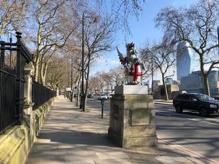
From where I live, the City border is most conveniently met at Goswell Road, approaching the Brutalist spectacle of the Barbican Estate. The Barbican towers will loom large in the background at various points on our route, but for now we turn away down Baltic Street West (becoming Baltic Street East) past our first dragon, to join Golden Lane and head south. Immediately we pass the tall, narrow profile of the Blair Associates building at number 88, as we head towards the portal into the Beech Street underpass, with the Cripplegate Free Library building on the right.
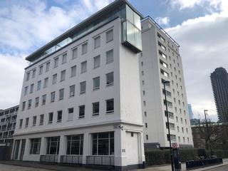
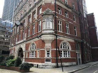
Entering the underpass, we turn left and proceed for a short distance before emerging beside Cromwell Tower. Beech Street becomes Chiswell Street and we continue before turning right on to Moor Lane and then left on to Ropemaker Street. We're already amongst a forest of high-rise office buildings here.
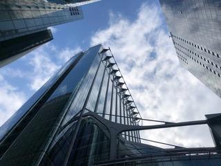
Continuing along Ropemaker Street, we cross Moorgate on to South Place and then turn left on to Wilson Street. There was once a dragon at this point on Moorgate, but it has apparently been removed while Crossrail works continue nearby. At the Wilson Street crossroads we find the Flying Horse pub, which stands at the intersection of the City to the south-east, Islington to the west/north-west and Hackney to the east. Turning right on to Sun Street, we keep the imposing Broadgate estate on our right and eventually behind us as we continue on Appold Street.

Progressing northwards, Appold Street becomes Worship Street and turns to the east, as we pass between yet more high-rises. As we reach Norton Folgate, Principal Place – one of the newest developments in the area – can be seen to the left. To the right, another dragon marks the northern edge of the City.
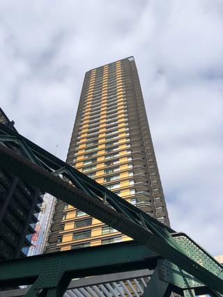
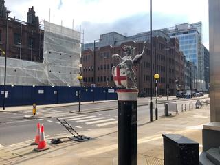
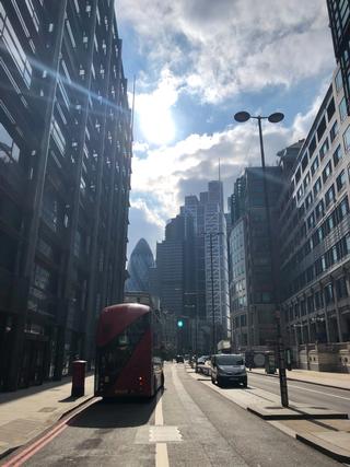
Norton Folgate becomes Bishopsgate as we trundle deeper into the forest. An opening to the left reveals the southwest corner of Spitalfields Market, and we turn left on Brushfield Street to briefly face it. Spitalfields was a trade market from 1682 up until the early 1990s and survives today as a food, crafts and fashion market open to the public.
From Brushfield Street we turn right on to Fort Street and then Sandy's Row. This joins Middlesex Street from which you can see the unusual angular balconies and walkways of the Middlesex Street Estate, a Corporation of London housing development.
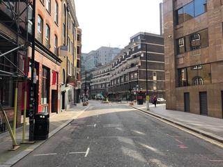
Middlesex Street eventually takes us to St Botolph Street and then meets Aldgate High Street, where we turn right. Just on the right here at the corner of Aldgate House is another dragon.
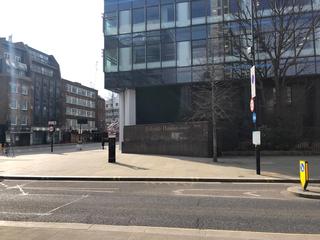
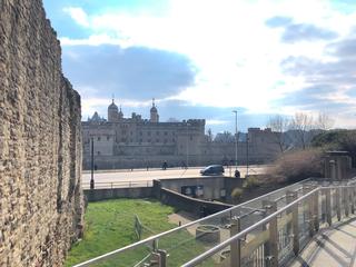
We proceed westwards on Aldgate High Street until we reach the top of Minories, where we turn left. As we near the bottom end of Minories there's a sort of one-way gyratory system that forms a loop beneath the DLR and railway tracks running into Fenchurch Street. This can be slightly intimidating on a bike at busy times so if you'd rather, you can easily walk the short distance south to the end of Minories. If on the road, we ride three sides of the square formed by the gyratory and then hop off at the traffic lights just as you rejoin Minories. We're heading for the pedestrian walkway of Trinity Place, approaching Tower Hill tube station on foot past a section of the old city wall. Over the road is the Tower of London, conspicuously outside the City of London boundary. If we keep right past the tube station entrance, we eventually find ourselves at Trinity Square and Cooper's Row where we can get back on our bikes.
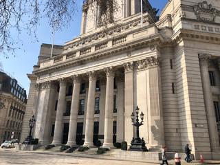
Ahead of us now are the huge Corinthian columns of Ten Trinity Square, an impressive Grade II* listed building dating back to 1912, once home to the Port of London Authority, now a hotel. Above the columns can be seen an ornate state of Old Father Thames himself.
From Trinity Square we join the segregated cycle path of CS3 westwards on Byward Street, which becomes Lower Thames Street. There's a dragon opposite, just by the entrance to Tower Hill Terrace on the south side of the road.
We're approximating the City boundary for the next little while, as it's actually located in the middle of the Thames, with the curious exception of the entirety of London and Blackfriars Bridges which are both under City authority. It's possible to ride nearer the riverside in places if you so wish, but I find the paths a little tangled and inconsistent and often (rightly) busy with foot traffic, so for the purposes of this route we'll keep to the far more convenient roads and cycle paths nearby.
As we descend the slope of the Lower Thames Street cycle path, we're confronted with the elongated profile of Custom House, still used by HMRC, and then Old Billingsgate Market beside it. First constructed in 1850 and rebuilt in 1875, this was the largest fish market in the world in the 19th century. The market itself was moved to a site on the Isle of Dogs in 1982, and the building is now a Grade II listed events venue.
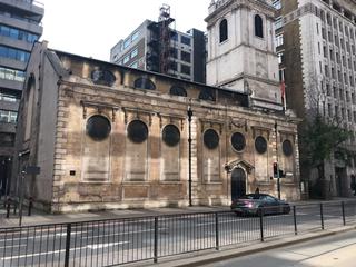
Continuing along Lower Thames Street we can then see the church of St Magnus the Martyr on the opposite site, just before we pass Adelaide House and head underneath the north end of London Bridge, where Lower Thames Street becomes Upper Thames Street. We've already ridden underneath some of the City's famous "pedways" – elevated sky bridges for pedestrians – which were once imagined as the solution to the City's traffic woes, but never quite caught on. A few more of these can be seen overhead as we proceed.
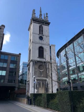
We continue on for some distance more along CS3, passing underneath Cannon Street station and the large office complex that adjoins it. Eventually the path of CS3 joins Castle Baynard Street and moves a little further from Upper Thames Street. Before we enter the Castle Baynard Street tunnel, the curious remains of St Mary Somerset church can be seen on the right – just a lone tower, the main building having been demolished in 1871.
Entering the tunnel, keep an eye out to the right-hand side, as each successive opening offers slightly improved chances of spotting St Paul's Cathedral behind the adjacent buildings. The tunnel itself also made an appearance as the location of a brief car chase in the James Bond film Spectre.
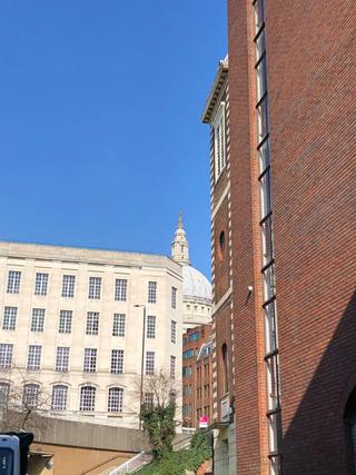
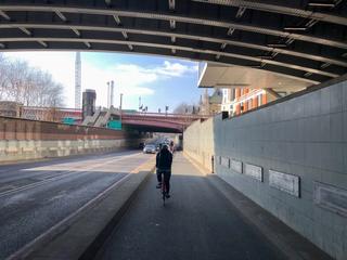
Eventually we emerge on to Puddle Dock and then dip below Blackfriars Bridge on the Blackfriars Underpass. This brings us to the Victoria Embankment where the cycle path crosses over the road to the riverside at the traffic lights. At this point we're presented with a choice. To follow the true City boundary, which turns north at Middle Temple Lane, it's best to stay on the north side of the road and walk the short distance to the entrance to that street. However, during the COVID-19 pandemic the entrance to the Middle Temple has been closed except to residents, and in normal times is only open between 8am and 8pm Monday to Friday. Therefore for the time being this route includes a diversion via Temple Place and Arundel Street.
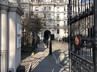
Middle Temple, like many of the Inns of Court in the City of London and neighbouring City of Westminster borough, is a wonderful oasis well worth a visit, so I very much recommend trying to see inside when times and circumstances permit. For now however the most straightforward – albeit less scenic – diversion is to continue on the Embankment until we pass Temple station, at which point we can use the crossing to join Temple Place. There's a pair of dragons here on either side of the Embankment at the junction with the eastern end of Temple Place.
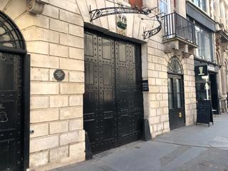
From the apex of Temple Place we turn left on to Arundel Street, then at the top of the slope use the crossing to turn right on to the Strand, where the huge Royal Courts of Justice can be seen on the left. As this road becomes Fleet Street, you can see a large wooden door on the right-hand side where Middle Temple Lane (and perhaps, our future selves at some point) would emerge.
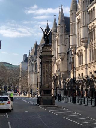
Behind us there's a chance to see another dragon, of a different shape this time, on a pillar in the middle of the street. This was an earlier design that was ultimately only used once, as IanVisits explains in his excellent article.
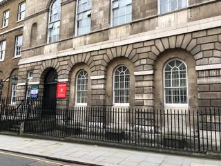
From Fleet Street we turn left to head up Chancery Lane, home to many other historical curiosities, legal chambers and storied old shops. Towards the top on the left-hand side, the frontage of 10 Stone Buildings can be seen, home to the Inns of Court Yeomanry and signed for the Army Reserve Centre, and still sporting visible bomb damage on its facade from a German aerial raid in WWI.
From the top of Chancery Lane we turn right on to High Holborn. Across the junction by the entrance to Chancery Lane tube station we see the impressive terracotta frontage of Holborn Bars, AKA the Prudential Assurance Building. The interior areas of this are well worth a wander if you have the time. Just before Holborn Bars, there's also another pair of dragons – one on the corner at the end of Gray's Inn Road, and a matching one on the south side.
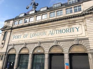
Carrying on, we take a left on to Charterhouse Street, descending the slope towards the corner of the old Smithfield Market complex. This is undergoing protracted redevelopment to be (among other things) the new home to the Museum of London, but it's not quite there yet. There's a final dragon here on an island between the cycle path on Farringdon Street and the vehicle lanes. We cross over Farringdon Street and note the buildings of the Port of London Authority and Central Cold Storage, once a key part of the market, on the left.
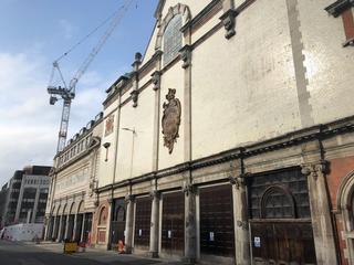
There has been a market on this site for at least 800 years, and the nearby streets of Cowcross Lane and Cock Lane conjure up images of livestock movements and trade of long ago. The market is still in daily operation, though during the day it can be hard to tell as most of its activity takes place long before regular folks are awake, and it can appear deserted the rest of the time. As we continue, Charterhouse Street becomes Carthusian Street and we pass Charterhouse Square on the left. At the top of this square can be found the Charterhouse itself, an almshouse and former priory dating back to 1371. Reaching Aldersgate Street and with the Barbican ahead of us once again, we take a left to bring us back to Goswell Road and the point where we began.
Dragon completionists may wish to add an extra-curricular cycle across Blackfriars Bridge, which sports a dragon on the central median at the southern end, and London Bridge, which has a matched pair at either side of the road at the southern end.
Published: 7th March 2021
Updated: 16th October 2022
