- Finsbury Park
- River Lea
- Springfield Park
- Hackney Marshes
- Queen Elizabeth Olympic Park
- Hackney Wick
- Victoria Park
- Regent’s Canal
- City Road Basin
- Clissold Park
An ascent of the hectic A503 doesn't make for the most auspicious start to this tour – another long one at around 27km – but you'll have to trust me that the best bits of this route are in its extensive middle.
Just a note that this route includes a fair amount of riverside and canalside paths. These can get very busy at weekends, so I would recommend tackling this particular route on a weekday if you can, or making an early start, in order to avoid shared-use annoyance.
As with Islington, we begin on the bustling Blackstock Road with its many cafes (including Salt the Radish, owned by my wife), and strike out to the north. Navigating the one-way loop of Rock Street we end up facing the forecourt of Finsbury Park station before turning right and meeting the corner of Finsbury Park itself.
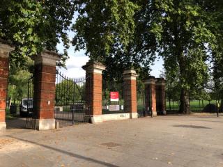
It's possible to cycle through the park until the path takes you to the crossing at Green Lanes, or stay on the parallel Seven Sisters Road – the boundary itself – and turn left at the junction at Manor House station. Shedding all that height we just gained, we then descend Green Lanes until we reach Hermitage Road – there's a set of traffic lights here that can be helpful in making the right-hand turn. We are trying to follow the route of the New River just to the south, so we turn into Eade Road and follow it along past the industrial edge of the Harringay Warehouse District and the prominent "OCC" chimney (apparently belonging to the Oriental Carpet Centre).
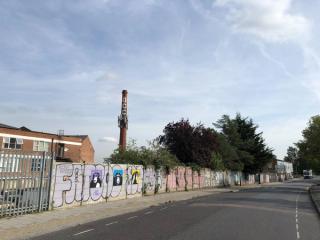
Reaching Seven Sisters Road once again, a quick left-and-right takes us into Vartry Road alongside the impressive Woodberry Down Baptist Church. We follow this west past a great many terraced houses until we meet Holmdale Terrace and the railway cutting by Stamford Hill station, whose platforms exist partly in Hackney and partly in Harringay. We turn right, then left by the station and left again on to Hillside Road to try to follow the boundary as closely as possible. We follow Hillside Road north and through a width restriction, round to the east before it brings us out at Stamford Hill.
Stamford Hill (the A10) can be very busy so caution is advised as we attempt to turn right and go back uphill for a short distance before taking a left into Olinda Road. We follow this as it turns and joins Craven Park Road, taking a right and following the road all the way to its terminus at the River Lea.
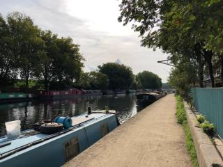
We join the path alongside the River Lea and are immediately transported into a (usually) bucolic scene of pretty narrowboats and old wharves and warehouses. As we continue, the path deviates slightly from the riverbank to take us along the foot of Springfield Park. As we follow the curves of the path under the trees, it eventually takes us back to the river's edge and past The Anchor and Hope pub, from where the Walthamstow Marshes opposite start to become visible.
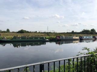
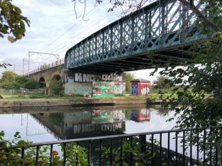
This section of path also forms part of section 13 of the Capital Ring walk around London. As we continue to follow the river, dividing Hackney from neighbouring Waltham Forest, the path widens and eventually takes us to the Lea Bridge Road, which we pass beneath before arriving at the Princess of Wales pub. There used to be a narrowboat-based bike workshop here, but sadly it was closed up and quite derelict-looking last time I passed through.
We take the bridge over the River Lea Navigation, which forks from the River Lea and together with which encloses the Hackney Marshes. This expanse of land looks very much like an island on the map and according to one local historian may well have given Hackney its name. From the bridge I was able to spot a submerged pipe pumping oxygen into the water in an effort to improve conditions for local fish and combat pollution.
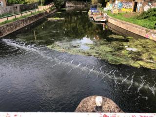
The Hackney border encloses this (possible) island of the Marshes, and the next section takes us along some beautiful paths in and out of the woodland on the north side of the area, following the river. As we cross the open space we get a glimpse of the Docklands in the distance.
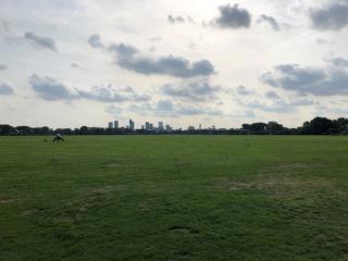
As we approach the Hackney Marshes Centre we cross another bridge over the River Lea to reach another expanse of football pitches and spectator terraces. It's hard to see it beyond the trees, but just to the north of here lies New Spitalfields Market, displaced from its former home in the west of Tower Hamlets, which we may visit another time. Continuing south, we climb a short ramp past the terraces to take us over the Eastway, then the A12, and enter the Queen Elizabeth Olympic Park.
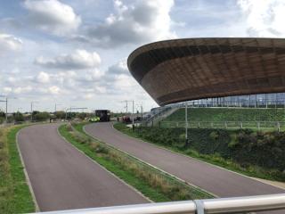
There's a lot to explore here, including the Change Please cafe and London Blossom Garden nearby, not to mention the amazing VeloPark, so some wandering off-route is highly recommended. When you're ready to continue, we'll follow a series of meandering paths alongside the river, heading south until we start to exit the park along Clarnico Lane and Carpenters Road, crossing the Navigation into Hackney Wick.
The Wick is a collision of old and new as shiny high-rise developments start to squeeze out small crafty businesses and studios in knackered old warehouses, many of which had not long migrated from Shoreditch as gentrification took hold there. A few enclaves bravely hold on, including Queen's Yard on the right as you cross the canal, home to Crate Brewery & Pizzeria, Old Street Brewery, Howling Hops and others. We follow White Post Lane past the striking design of the Hackney Wick Overground station until we meet Wallis Road and cross over the A12 via the footbridge (which includes its own little cycle lane).
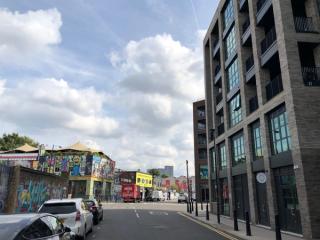
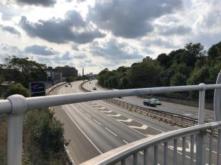
Tower Hamlets claims Victoria Park for itself so for now we'll follow Cadogan Terrace around the park perimeter before finally entering it at the People's Park Tavern. From here a series of wide, sweeping footpaths take us around the park, past the Burdett-Coutts Drinking Fountain, or Victoria Fountain, a Grade II* listed fountain and monument.
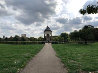
Eventually the path deposits us at the Regent's Canal, whose towpath we follow to the west until we reach the southern tip of Broadway Market. There are steps up to road level here, but it's easier to continue under the bridge and double back using the ramps on that side.
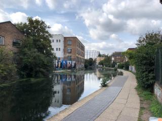
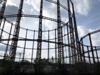
From here we take a winding route through the back-streets off Pritchard's Road, Teale Street and Kay Street to join Goldsmith's Row, where there are some notable establishments including The Virgin Queen pub and Little Georgia. We ride alongside Haggerston Park and Hackney City Farm to join Hackney Road and head into Shoreditch on this slightly busier section.
As we reach the church of St. Leonard's, Shoreditch, we turn into the lanes again to follow Austin Street to the aptly-named Boundary Street. Some contrasting signage can be seen here with both Hackney and the former Metropolitan Borough of Shoreditch putting their mark on the street.
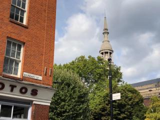
We continue on Boundary Street until it meets Redchurch Street, where a left and a right takes us on to Ebor Street and across Bethnal Green Road (often busy) and into Braithwaite Street, passing below the concrete sarcophagus of Shoreditch High Street station and into the "Graffiti Tunnel". This takes us on to Wheler Street and eventually Commercial Street by the Commercial Tavern.
The precise boundary follows the railway lines beneath our feet and the closest approximation by road takes us up to the junction with Shoreditch High Street, then south to a right turn on to Worship Street by the vertiginous Principal Place. As we're at the corner of the City of London here there's also a dragon boundary marker to spot.
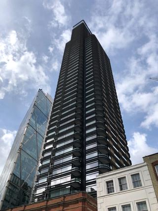
We're suddenly navigating the financial district, hemmed in by unfriendly high-rise offices. A series of turns circumscribe the southern peninsula of the borough as we ride down Appold Street and Sun Street before taking a right on to Wilson Street by the Flying Horse pub. We then head back towards the familiarity of Shoreditch as we ascend Paul Street, deviating via Clere Street to Tabernacle Street which eventually brings us to the heavy traffic of Old Street.

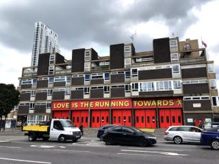
Some slightly less pleasant (but reasonably brief) sections follow as we navigate Old Street Roundabout (no longer a roundabout) to head north on City Road. As we start to get amongst the shiny towers of the City Road Basin we at last leave the busier roads behind as we turn on to Wharf Road and follow it north, passing several attractive old warehouses and crossing Regent's Canal once more.
The boundary passes along the towpath for a distance here but as with the Islington route I've taken us along neighbouring paths and streets instead, as I find the towpath a bit stressful. It's not especially lengthy however so it's up to you. Off-canal we follow Baldwin Terrace through some pedestrian paths to the surprisingly boulevard-esque Arlington Avenue, then cross New North Road to Baring Street. At the bottom of Southgate Road we find the Briggs Building and this is where you would rejoin the road from the canal path, if you so chose.
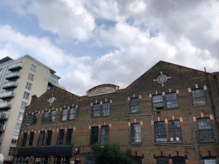
We're into the final furlongs now. Ascending Southgate Road, several examples of double-borough signage are visible to the left and right as we pass various interesting pubs and eateries including the De Beauvoir Deli and The Hunter S. pub. We eventually reach Balls Pond Road where we take an awkward right turn at the crossroads. Then just before the next crossroads with Kingsland Road we hop up on to the pavement to join the end of Kingsland Passage and head north to join Boleyn Road.
The long sweep of Boleyn Road takes us over the Overground tracks and past the Army & Navy pub towards Newington Green. We do a quick three-quarter circuit of this before departing northwest on Green Lanes. At The Leconfield pub we take a left to take in a little corner of the borough at Petherton Green before rejoining Green Lanes and continuing north towards the corner of Clissold Park.
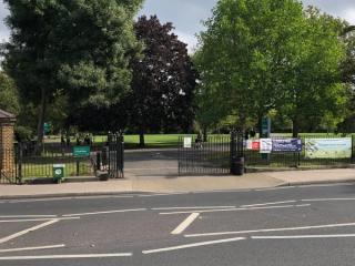
A little further along the edge of Clissold Park we take our final left turn on to Mountgrove Road, which after passing the very recommendable Top Cuvée restaurant deposits us back on Blackstock Road, where we began.
Published: 22nd September 2022
Updated: 16th October 2022
