- Regent’s Park
- Post Office Tower
- Centre Point
- Lincoln’s Inn Fields
- Middle Temple
- Victoria Embankment
- Palace of Westminster
- Kensington Gardens
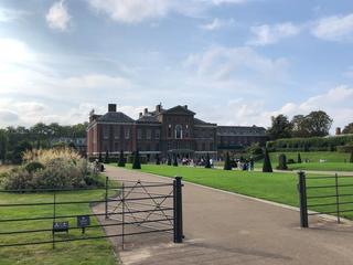
- Kensington Palace
- Alexandra and Ainsworth Estate
- Primrose Hill
- ZSL London Zoo
Stretching from the riverside to the (relative) heights of West Kilburn and Maida Vale, the City of Westminster covers a surprising area, both geographically and demographically. A city in its own right within the greater metropolis of London, the borough was created in 1965 as part of the formal establishment of Greater London, and inherited the city status previously granted to the Metropolitan Borough of Westminster. It encompasses many of the most famous sights and localities in London, a great number of which can luckily be seen on a tour of its borders by bike.
Westminster has one of the longer boundaries of the central boroughs north of the river, but you're never far from refreshments and pleasant places to stop and rest. This route describes a clockwise loop, and I believe that to be the best direction to navigate, but as with most of the boroughs either is possible with a bit of consideration given to one-way systems.
From where I live, a natural point to meet the loop is at the northeast corner of Regent’s Park, so that’s where we’ll begin. The largest park in central London (with Hyde Park and Kensington Gardens, which we will meet later, coming in at second and third), the park is ringed by the Outer Circle, upon which sit many staggeringly expensive residences, and is beloved of road cyclists for its mostly flat grade and (usually) relatively low traffic levels. The border cuts down through the middle of the park, with the eastern slice and this bit of the Outer Circle belonging to neighbouring Camden.
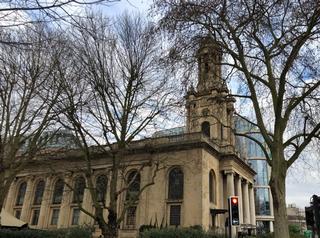
At the bottom of the park we head for the gates and turn left, then left again on to Albany Street. Ahead of us is the former Holy Trinity Church, Marylebone, a Grade I listed former Anglican church designed by Sir John Soane. Built in 1828, its use declined in the 1930s and these days it’s “the world’s first wedding department store” and an events space. It sits on an island formed by roads, and occupies a little notch sticking out of the top of the Westminster borough. Keeping the church on our right, we follow the road around until we once again face Euston Road and Great Portland Street station.
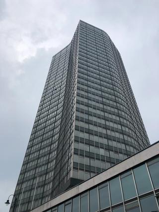
The vagaries of one-way streets in this area mean we have a little wiggling to do to try to follow the boundary. Crossing Euston Road on to Bolsover Street, we turn left on Greenwell Street and then take the second right on to Cleveland Street, getting our first glimpse of the Post Office Tower. We shortly meet a one-way system coming up Cleveland Street ahead of us, and turn left on to Maple Street and pass right below the tower. Built in 1964 and also known as the BT Tower, this was the tallest building in the UK until 1980 and has been Grade II listed since 2003. It was designed as a major communications hub with line-of-sight microwave antennae mounted at the top, which are still in use today.
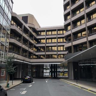
Passing the tower, we turn right on to Fitzroy Street which then becomes Charlotte Street, and then after several junctions, Rathbone Place. Here we take a left on to Gresse Street, turn the corner, then turn left again on to Stephen Street. This takes us underneath the 1+2 Stephen Street building, home to several film, media and production companies including BFI, and on to Tottenham Court Road.
Turning right, we make our way down to the crossroads with Oxford Street, and get a great view of Centre Point and the newly redeveloped Tottenham Court Road station. Crossing over on to Charing Cross Road, we enter the Theatreland area and pass the last remaining music shops of Denmark Street on our left. Eventually we reach Cambridge Circus, where we cross over to continue on Charing Cross Road before taking a quick left on to Litchfield Street. This becomes West Street and we turn right on Upper St Martin's Lane to reach the six-way junction where we turn left on to Long Acre.
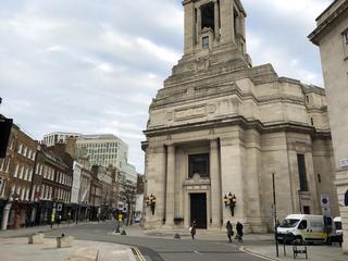
We’ve now entered the Covent Garden district, and since riding this part of the border shared with Camden I've simplified things a bit for the sake of hassle reduction, so we'll stay on Long Acre until we reach Great Queen Street and Freemasons’ Hall. Built in 1933, this is the headquarters of the United Grand Lodge of England. At a slightly different scale, on the plaza opposite you can find several examples of the “Camden bench”, a cast concrete piece of street furniture designed to deter rough sleeping and anti-social behaviour, and an infamous example of “hostile architecture”.
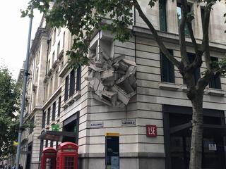
Leaving the Hall to our left, we turn right down Wild Street, passing a Peabody Estate on the right, then join Kemble Street and reach the major artery of Kingsway. We're intending to cross straight over on to Sardinia Street, however the central barriers and exit from the Strand Underpass are in our way, so we’ll turn left and head up the road a few yards to the Pelican crossing to reach the other side instead. As you reach the entrance to Sardinia Street, don't miss the striking sculpture at the corner of the LSE building to your left.
This brings us to Lincoln’s Inn Fields, a square surrounded by a great deal of history including legal chambers, LSE buildings and residences. We’ll follow the one-way system around three sides of the square, on the north side passing Sir John Soane’s Museum at no. 13, in a neat link to the Holy Trinity church we saw earlier by the Euston Road. As we reach the south-east corner we see the grand entrance to Lincoln’s Inn itself. One of the four ancient Inns of Court, this self-contained time capsule with its manicured lawn is well worth a visit – it is, however, only open on weekdays and sadly not open to the public at all during COVID-19.
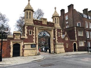
We leave the square on Searle Street and turn left on to Carey Street, passing The Wig Box, in case you’d forgotten we’re in the heart of the old legal district, and The Seven Stars, a splendid place to enjoy a lunchtime sharpener after a taxing morning in chambers. At the corner of Chancery Lane up ahead we’d be at the intersection of the City of Westminster behind us and to the right, Camden to our left and the City of London straight ahead. However to avoid the one-way restriction on Chancery Lane we'll dive off down Bell Yard to the right before we reach it, cross the pavement at the bottom, and drop on to Fleet Street.
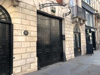
As similarly noted in the City of London route, the border we’re tracing heads down Middle Temple Lane, however at the time of writing this is sadly closed to non-residents due to COVID-19. For now, our route (and the attached GPX file) diverts along Fleet Street, down Bouverie Street and Temple Avenue to meet the Victoria Embankment and its excellent segregated cycleway, part of CS3. Crossing to the riverside and turning right to head west along CS3, you'll see the Middle Temple gate across the road after a short while – hopefully we can return to that another time. I'll update this route and the GPX file at such time as general access to Middle Temple Lane is restored.
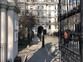
We’ll spend nearly 2km on this excellent bit of cycling infrastructure as we follow the curve of the river past several notable sights, including the National Submarine War Memorial, Cleopatra's Needle, the Sir Joseph Bazalgette Memorial, and Royal Air Force Memorial. Eventually the Embankment cycleway brings us to the north side of the Palace of Westminster, also known as the Houses of Parliament, where we can see the Elizabeth Tower, home to Big Ben. This is currently clad in scaffolding while undergoing repair, but is due to be completed in the second quarter of 2022.
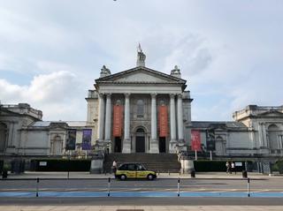
The borough boundary is in the river, so we’ll stick as close as we can while staying on the road. Turning right and entering Parliament Square, we turn left and follow this side of the Houses of Parliament on to Abingdon Street, which becomes Millbank. With Victoria Tower Gardens to our left, we continue to the roundabout with Lambeth Bridge and cross over to continue along Millbank. On the right we pass another Grade II listed building, Millbank Tower, built in 1963 (briefly the tallest building in London, until the completion of the Post Office Tower the following year) and currently undergoing renovation from office space to hotel and luxury apartments. Just beyond, also on the right, is the Tate Britain.
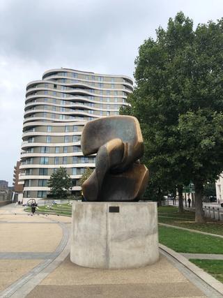
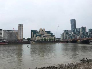
Just as we approach the junction with Vauxhall Bridge, on the left by the riverside is a sculpture by Henry Moore, Locking Piece. This is a great place to stop and admire the river, Vauxhall Bridge itself, and the SIS Building, AKA the MI6 Building, across the water.
Crossing the junction, we stay on the cycleway on Grosvenor Road and follow it along to Chelsea Bridge and the junction with Chelsea Bridge Road, getting a good view of Battersea Power Station on the opposite bank. To turn right on to Chelsea Bridge Road from the cycle path is a bit precarious, so I find it much easier to dismount and cross the two arms of the junction on foot.
Proceeding up Chelsea Bridge Road, we take a right at the lights on to Pimlico Road, then a left on to Passmore Street shortly thereafter. We begin to pick our way through the back-streets of Belgravia to follow the Westminster boundary and bypass Sloane Square. At the end of Passmore Street we turn right on to Graham Terrace and then left on to Bourne Street, which we follow until we meet Cliveden Place at the end, where we turn right. Throughout this section, there's ample opportunity to observe the twin signage on either side of the streets we pass along, at this stage Westminster on the right and RBKC on the left.
Cliveden Place becomes Eaton Gate, and we turn left on to Eaton Place. We follow this towards the Knightsbridge area as it becomes Chesham Street and then Chesham Place, then Lowndes Street, which we follow all the way to Lowndes Square. We circle the square, exit at the north-east corner through the modal filter, and turn left on to Knightsbridge itself.
This section can get a bit hectic in traffic, but we're not on it for too long. We keep left as Knightsbridge forks with Brompton Road, staying on that road past Harrods. After a short distance we keep right to eventually turn right on to Montpelier Street and then left on to Cheval Place. A right turn on to Rutland Street after a short distance takes us past a pretty terrace of houses, and as Rutland Street bends round to the right, look for a small portal in the wall on your left which takes us up a step and on to Rutland Mews (if you’re riding a cargo or otherwise oversized bike, you can route around this gate and step by returning to Montpelier Street, following it up to Knightsbridge, then left on Rutland Gate, following it all the way down to Rutland Mews).
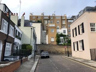
We pick our way along Rutland Mews, passing through the arch on to Ennismore Gardens Mews and joining a short but invigorating section of pavé. At the corner there's a ramp down on to a section of pavement, which we’ll follow on to Princes Gate Mews and some more cobbles. This eventually meets Exhibition Road, which we cross to join Imperial College Road.
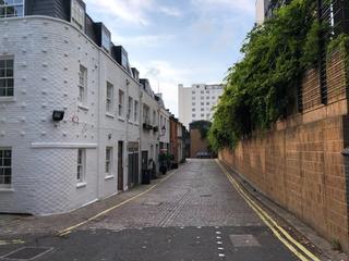
This road takes us through the middle of the Imperial College’s South Kensington campus, which involves navigating a vehicle barrier and a pedestrian gate but is otherwise quite passable by bike. Once we emerge on the other side, we find ourselves on Queen’s Gate where we turn right and continue up to Kensington Road at the top of the road. The chap on the horse immortalised in statue form just here is Lord (Robert) Napier.
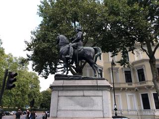
Turning left, we have another brief section of possibly busier traffic to negotiate. At the next traffic lights, we want to cross the road to enter Kensington Gardens at the pedestrian gate, which is again best accomplished by dismounting and walking across on a red light. Entering the park, we have ahead of us “the Mountain of Round Pond”, the gentle climb of Broad Walk up to Round Pond on the right and Kensington Palace on the left.
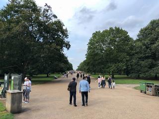
Continuing straight on through the park to the Bayswater Road gate, we turn left on this sometimes busy road (on which we roll for only a few hundred metres) before turning right on to Palace Court. Admiring the picturesque mansions at the end of this street, we take a left on to Moscow Road and then right on to Chepstow Place.
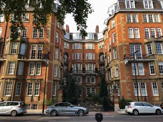
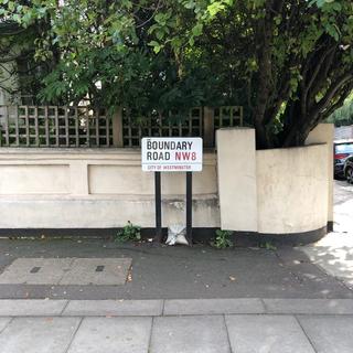
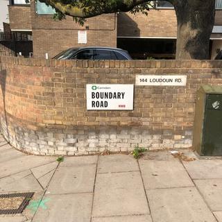
Chepstow Place meets Westbourne Grove and we take the 90º left (not the first, sharper one) at the traffic lights to join it. At the mini roundabout a few hundred metres further we turn right on to Ledbury Road, and start to see the first signs of leaving the pomp of Kensington and Notting Hill behind. At the top of Ledbury Road we cross Westbourne Park Road with a quick left-and-right on to St Luke’s Road. As earlier in Belgravia, these dense streets offer multiple opportunities to see dual borough signage for the street names to the left and right.
After St Luke‘s Road we turn right on to Tavistock Road, which joins Great Western Road and passes under the Westway by Westbourne Park Station (on the Circle and Hammersmith & City lines), and then shortly over the Grand Union Canal as we enter the Maida Hill area.

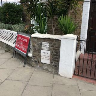
Turning left, we navigate our way down Harrow Road for about a kilometre, noting the slightly elevated route of the canal through gaps in the buildings to our left, before eventually reaching the traffic lights of the crossroads with Kilburn Lane and turning right. Going up the slight incline, we make another right turn to stay on Kilburn Lane, and then another. We've got signage of the London Borough of Brent on our left now, and on the right here there are a pair of marker stones set into a garden wall at the pavement edge, indicating distance to the historical borders of the old parishes of Paddington and Chelsea.
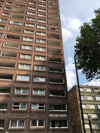
Continuing on Kilburn Lane once more, around the gyratory, we join Carlton Vale for a short distance before turning right on to Malvern Road. This becomes a shared-use path briefly, passing behind a school, before returning to being a road, and on the left we look across a small southern spur of Brent and some venerable Brent public housing stock in the form of Dickens House, and its twin behind it, Austen House.
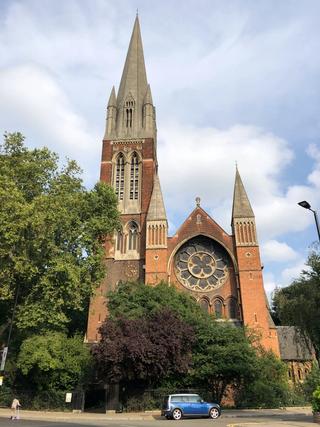
At the bottom of Malvern Road we turn left and left again to head up Kilburn Park Road, going north again to circumscribe this projection of Brent to our left. Over the crossroads, we take a left on to Rudolph Road, passing the impressive church of St Augustine’s, Kilburn, its size apparently earning it the nickname of “the cathedral of North London”.
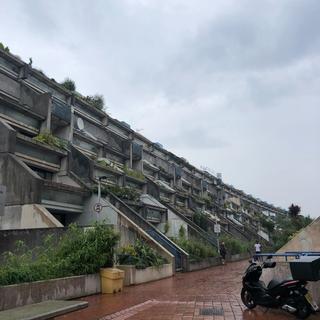
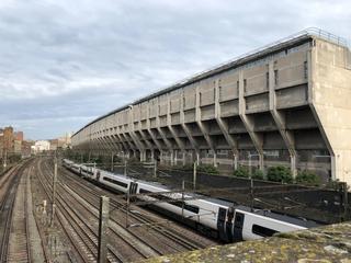
After the church, we turn right on to Oxford Road and climb the slight gradient up to Kilburn High Road, and the intersection here of the boroughs of Brent, Camden and the City of Westminster. We turn right, then shortly left on to Greville Place. Ascending Greville Place, we eventually meet Abbey Road (yes, that one – the famous studios are about a kilometre along the road to the south-east). The Westminster boundary continues straight across on to the aptly-named Boundary Road, but there's a bonus site of interest near here that’s worth pointing out. Just off the route to the north-west, about 200 metres away, you can find the end of the Alexandra and Ainsworth Estate, a massive Grade II listed Brutalist development with terraced interior and very distinctive ”ziggurat” rear profile thrusting over the railway tracks – it’s really something.
We’re on the home stretch now as we wend our way towards the Primrose Hill area and our starting point. We follow Boundary Road up the hill (probably the steepest slope on the route) and cross over Finchley Road at the dedicated bike signal and eventually turn right on to St John’s Wood Park. We take a left on to Queen’s Grove, then a right on to Woronzow Road, named after a former Russian Ambassador to the United Kingdom, for whom there’s a plaque about halfway along on the left. We turn left on to Norfolk Road and then right on Avenue Road (more obvious dual signage at this junction), which we follow downhill for a modest distance before taking a left on to St Edmund’s Terrace. The road goes up again as we climb towards the edge of Primrose Hill, where we follow the road round to the right on to Ormund Terrace and join Prince Albert Road as the road descends once more.
The aviaries of ZSL London Zoo are ahead of us here as we turn left and follow the road around. After the second set of traffic lights there’s a footbridge over the canal on the right, where we (should) dismount and walk to join the Outer Circle once again. One last left turn, and we’re back where we started at the Gloucester Gate entrance to Regent’s Park.
Published: 5th October 2021
Updated: 16th October 2022
